Lineament Detection
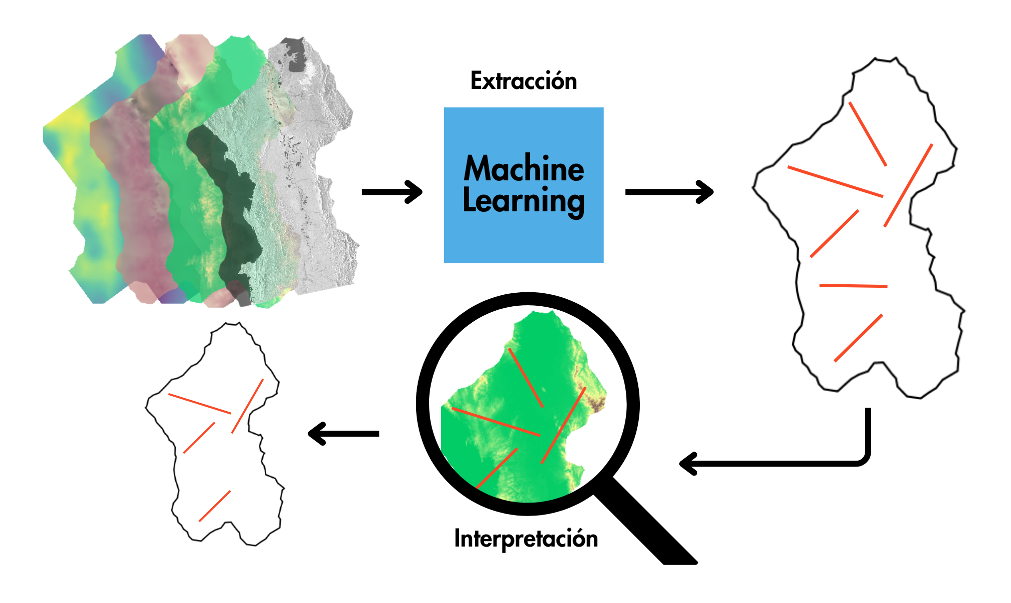
Training a Convolutional Neural Network (CNN) with a Fault Mapping Dataset for Linear Structure Detection
This tutorial (training_FaultMapping.ipynb) reproduces a practical example of using CNNs for image-to-image transformation, specifically for linear structure detection, based on [1], [2], and [3]. The model is trained using a fault mapping dataset [1] and implements the U-Net architecture.
October 27, 2025
Accessing DEMs and Sentinel-1 Data from the Planetary Computer catalogs
In this post, I reproduce the process of obtaining satellite data from the Microsoft Planetary Computer, focusing on Digital Elevation Models (DEMs) and Synthetic Aperture Radar (SAR) imagery. I also show how to access, visualize, and combine multiple items. The code examples DEM_getting.ipynb and sentinel-1_GRD_getting.ipynb are based on the official Microsoft Planetary Computer documentation: Reading Data from the STAC API.
October 5, 2025
Calculating Gravity from Topographic Raster Data
In this post, I present a reproduction of the Harmonica tutorial Gravitational effect of topography, implemented in the notebook gravity_from_topography.ipynb, using a Digital Elevation Model (DEM) sourced from Colombia en Mapas.
September 7, 2025
An overview of Geological Lineament Detection Using Gravity and Magnetic Fields
In this post, I provide an overview of the role of gravity and magnetic fields in geological lineament detection, based on several bibliographic resources I have studied.
August 19, 2025